One of the highest lakes on earth, then the same legendary pass every Annapurna Circuit trekker crosses. 13 days from Kathmandu: the Marsyangdi valley to Manang, a detour through Khangsar to Tilicho Lake at 4,919m, then back to the main trail for the crossing of Thorong La Pass and the descent into Muktinath. The remoteness of Tilicho and the achievement of the full circuit, in one itinerary.
The Tilicho Lake Trek is a 13-day adventure in Nepal’s Annapurna region that takes you to one of the world’s highest lakes and the beautiful Tilicho Lake.
This trek is known for being both challenging and rewarding. Since the lake lies in a remote part of the Annapurna range, it’s perfect for trekkers who enjoy exploring off-the-beaten-path routes. The Annapurna Tilicho Lake Trek offers a mix of adventure, nature, and culture that makes it a memorable journey for any traveler.
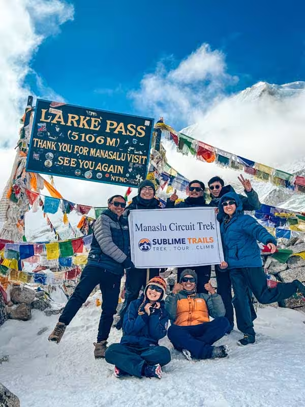
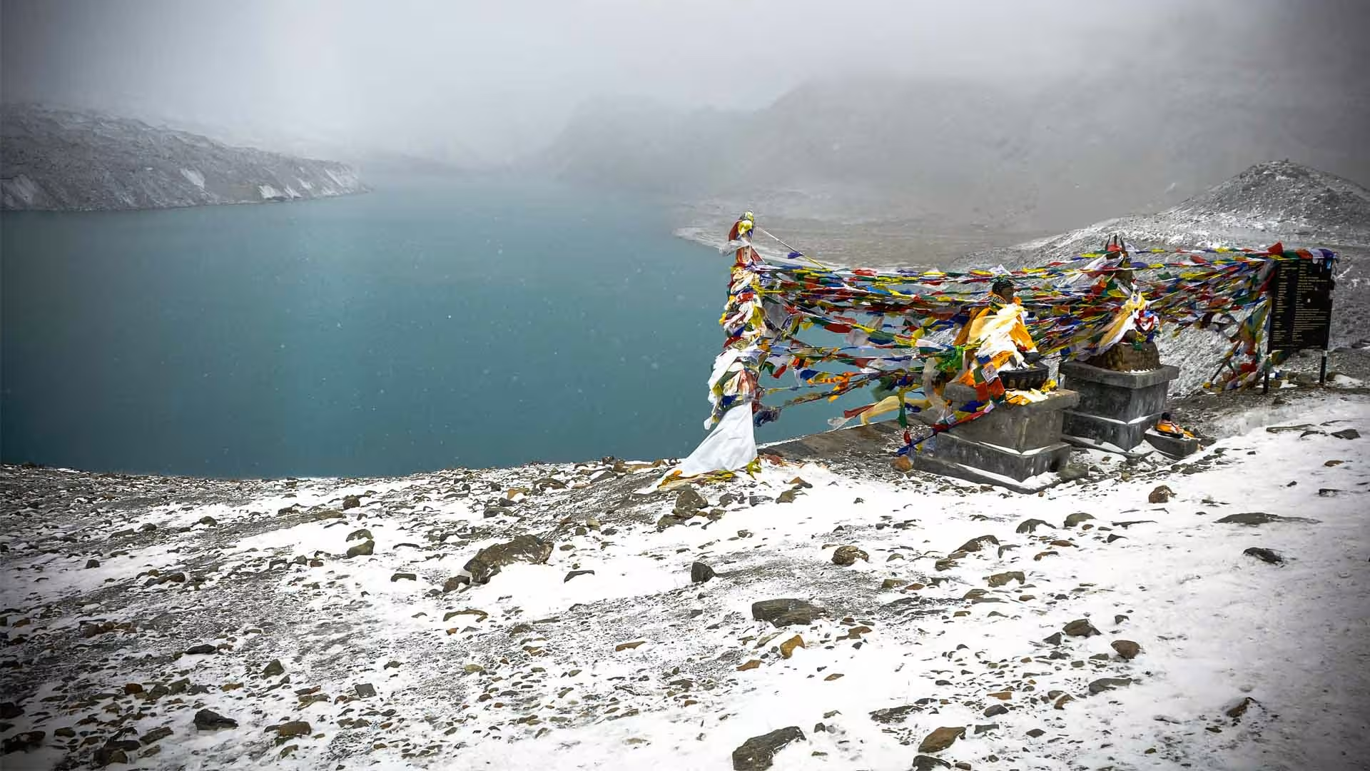
One of the biggest highlights of the trek is crossing the famous Thorong La Pass, which also connects to the Annapurna Circuit and Tilicho Lake Trek route. The landscapes change dramatically as you climb higher, from lush forests and green hills to dry, rocky areas that resemble the Tibetan Plateau. When you finally reach Tilicho Lake, its calm, turquoise water surrounded by snow-capped peaks feels truly magical.
Along the way, you’ll pass through small villages where people from different ethnic groups live. Their warm hospitality and unique traditions make the trek even more special. You’ll also enjoy clear views of some of Nepal’s tallest peaks, including Annapurna, Dhaulagiri, Machhapuchhre, Nilgiri, and Himchuli.
Tilicho Lake holds great religious importance, too. Many Hindus visit it to take a holy bath, believing it purifies the soul. During the trek, you’ll also visit the sacred Muktinath Temple, an important site for both Hindus and Buddhists. The area is dotted with colorful monasteries and ancient gompas that reflect the region’s spiritual side.
The trail starts from Kathmandu and follows the famous Annapurna route to Chame. From there, you’ll trek to Manang, a beautiful mountain village known for its peaceful atmosphere. After resting and getting used to the altitude, the trail continues to Tilicho Base Camp. The path becomes narrower here, but the views get even more stunning.
After exploring Tilicho Lake, you’ll rejoin the main trail to cross Thorong La Pass (5,416 m). The journey then continues to Muktinath and Kagbeni before ending in Jomsom which is a popular starting point for the Upper Mustang Jeep Tour. From Jomsom, you can either fly or drive back to Pokhara or Kathmandu. If you have less time, you can also return from Chame.
The Annapurna Circuit Trek with Tilicho Lake Trek is one of the best ways to experience both adventure and the natural beauty of the Himalayas. It’s a challenging trek, but the scenery, culture, and sense of achievement make it worth every step.
Trip Highlights
Journey Highlights
Tilicho Lake, One of the World’s Highest Lakes
The highlight of the trek is reaching Tilicho Lake at 4,919 m, surrounded by the rugged peaks of the Annapurna range. The final approach takes you through a barren, high-altitude landscape before the turquoise lake comes into view.
The Dramatic Trail to Tilicho Base Camp
The route from Khangsar toward Tilicho Base Camp feels noticeably wilder than the main Annapurna Circuit trail. Narrow mountain paths, steep slopes, and exposed terrain create a more adventurous trekking experience as you approach the lake.
Khangsar Village and the Hidden Valley
The trail passes through Khangsar, a traditional mountain settlement tucked beneath the surrounding peaks. Beyond the village, the landscape becomes increasingly remote and rugged as the trail enters the Tilicho Valley.
Views of Tilicho Peak and Gangapurna
As you approach the lake, Tilicho Peak and Gangapurna become prominent features of the landscape. The combination of glacial valleys, rocky slopes, and high Himalayan peaks makes this section particularly striking.
Two Major High-Altitude Experiences in One Trek
The trek combines the demanding journey to Tilicho Lake at 4,919 m with the crossing of Thorong La Pass at 5,416 m. Experiencing both in one itinerary makes this route more challenging and varied than a trek focused only on the main circuit.
Why Choose Sublime Trails for the Annapurna Tilicho Lake Trek
Highly Experienced Local Guides
Our highly experienced local guides have firsthand knowledge of the Annapurna and Tilicho trails, including the demanding sections between Manang, Khangsar, Tilicho Base Camp, and Tilicho Lake. They understand how terrain, weather, altitude, and individual fitness can affect a trekking day and use that experience to manage pace, rest stops, and route decisions on the ground.
A Realistic Plan for Tilicho and Thorong La
Tilicho Lake and Thorong La are the two defining high-altitude sections of this trek, so we plan the itinerary around the demands of both. The acclimatization day in Manang gives you time to adjust before heading higher toward Tilicho Lake and later crossing Thorong La at 5,416 m.
Contingency Planning for Changing Mountain Conditions
Mountain conditions can change quickly, and the original itinerary may not always be the safest or most practical option. Our team keeps alternative arrangements in mind for situations such as poor weather, trail disruption, transportation problems, or altitude concerns, allowing the guide and Kathmandu team to adjust the plan when necessary.
Altitude Monitoring That Goes Beyond Walking Pace
Above 3,000 m, how you feel matters as much as how far you have walked. Our guides watch for common signs of altitude problems, including headache, nausea, dizziness, unusual fatigue, changes in sleep, and loss of appetite, and can recommend slowing down, resting, or changing the plan when needed.
Support From Kathmandu to the Trail
Your guide has support from our Kathmandu-based operations team throughout the trek. This gives the field team someone to coordinate with when transportation, accommodation, weather, health, or other unexpected situations require additional arrangements.
Clear Advice Before You Commit
We don't present Tilicho Lake as an easy extension of the Annapurna Circuit. The trek reaches 4,919 m at Tilicho Lake and 5,416 m at Thorong La, with demanding high-altitude sections along the way. We explain these challenges before you book so you can decide whether the trek matches your experience, fitness, and expectations.
Flexible Decisions When Conditions Require Them
An itinerary provides a planned framework, but mountain conditions can make sticking rigidly to that plan unsafe. Our guides can adjust walking pace, rest stops, or the day's objective when weather, trail conditions, or a trekker's condition calls for a different approach.
Itinerary
Tilicho Lake Trek Detailed Itinerary
Day 1 - Kathmandu or Pokhara to Dharapani (1,860 m / 6,102 ft)
Kathmandu/Pokhara → Besisahar → Dharapani
Transport: Private premium 4WD Jeep
Driving distance: Approximately 220 km (137 miles) from Kathmandu / 145 km (90 miles) from Pokhara
Driving time: Around 7 to 10 hours from Kathmandu; varies from Pokhara depending on road conditions
Sleeping elevation: 1,860 m (6,102 ft)
Accommodation: Teahouse
Your journey begins with a private premium 4WD Jeep from Kathmandu or Pokhara, depending on your location. The route heads toward Besisahar before continuing deeper into the Marsyangdi Valley toward Dharapani.
From Besisahar onward, the road passes through Jagat, Chamje, and Tal, following the Marsyangdi River through increasingly narrow valleys. The scenery changes from green hills, farmland, and subtropical vegetation to waterfalls, pine forests, steep cliffs, and higher mountain terrain.
The road becomes rougher and more winding as you approach Dharapani. Travel time can change with road conditions, weather, traffic, and local road work, so your driver and guide will adjust the journey as needed.
You arrive in Dharapani, where you spend your first night before beginning the trekking section toward Chame.
Guide's perspective: The private 4WD is particularly useful on this section because conditions can change along the mountain road. Our driver and guide assess the road on the day rather than treating the estimated driving time as fixed.
Day 2 - Dharapani to Chame (2,670 m / 8,760 ft)
Dharapani → Bagarchhap → Danakyu → Timang → Thanchowk → koto → Chame
Trekking distance: Approximately 15 km (9.3 miles)
Walking time: 5 to 6 hours
Highest point: 2,670 m (8,760 ft)
Sleeping elevation: 2,670 m (8,760 ft)
Accommodation: Teahouse
Meals: Breakfast, Lunch and Dinner
After breakfast in Dharapani, you begin walking deeper into the Marsyangdi Valley toward Chame, the administrative center of Manang District. The trail passes through pine and fir forests, with the valley becoming narrower as you gain elevation.
Along the way, you pass through Bagarchhap, Danakyu, Timang, Thanchowk, and Koto with changing views of the surrounding mountains. The trail combines forest paths, stone sections, and stretches of mountain road, with the scenery becoming noticeably drier as you approach Chame.
The final section follows the Marsyangdi River toward Chame. On arrival, there is time to explore the village and rest before the next day's walk toward Upper Pisang.
Guide's note:
Today is not about gaining altitude as quickly as possible. The steady climb from Dharapani allows your body to begin adjusting to the increasing elevation while keeping the walking day manageable. Your guide will set the pace according to the group's condition and trail conditions.
Day 3 - Chame to Upper Pisang (3,300 m / 10,827 ft)
Chame → Bhratang → Dhikur Pokhari → Upper Pisang
Trekking distance: Approximately 14 km (8.7 miles)
Walking time: 5 to 6 hours
Highest point: Around 3,300 m (10,827 ft)
Sleeping elevation: 3,300 m (10,827 ft)
Accommodation: Teahouse
Meals: Breakfast, Lunch and Dinner
The trail continues from Chame toward Upper Pisang, initially passing through pine forest before reaching Bhratang, an area known for its apple orchards. From here, the valley opens toward the dramatic rock formation of Paungda Danda.
You continue through Dhikur Pokhari and gradually approach Upper Pisang. The landscape is noticeably drier than the lower Marsyangdi Valley, while the mountain views become increasingly impressive.
From Upper Pisang, you can see prominent peaks including Annapurna II and Annapurna IV, with Pisang Peak also forming an important part of the surrounding mountain landscape.
The trail climbs steadily throughout the day, so your guide will maintain a controlled pace as you approach and sleep above 3,000 m.
Day 4 - Upper Pisang to Ngawal via Ghyaru (3,660 m / 12,008 ft)
Trekking distance: Approximately 11 km (6.8 miles)
Walking time: 4 to 5 hours
Highest point: Around 3,660 m (12,008 ft)
Sleeping elevation: 3,660 m (12,008 ft)
Accommodation: Teahouse
Meals: Breakfast, Lunch and Dinner
Today you take the high trail through Ghyaru, one of the most scenic sections of the trek. The route climbs steeply from Upper Pisang through a series of switchbacks toward Ghyaru.
The higher position opens wide views across the Annapurna range. On clear days, you can see Annapurna II, Annapurna III, Annapurna IV, Gangapurna, Chulu East, Chulu West, Pisang Peak, and Tilicho Peak from different points along the route.
From Ghyaru, the trail continues across dry hillsides and open alpine terrain toward Ngawal. The surroundings now have a distinctly drier, Tibetan-influenced character compared with the forested valleys lower down.
Guide's perspective:
We use the high route through Ghyaru because it provides a better mountain panorama and gives you a gradual introduction to walking at higher elevations. Your guide will control the pace on the steep approach rather than rushing to Ngawal.
Day 5 - Ngawal to Manang (3,540 m / 11,614 ft)
Ngawal → Braga → Manang
Trekking distance: Approximately 9.5 km (5.9 miles)
Walking time: 3 to 4 hours
Highest point: Around 3,660 m (12,008 ft)
Sleeping elevation: 3,540 m (11,614 ft)
Accommodation: Teahouse
Meals: Breakfast, Lunch and Dinner
You leave Ngawal and continue toward Manang through the broad upper Marsyangdi Valley. The trail gradually descends before reaching Braga, one of the most distinctive villages on this section of the route.
Braga Monastery sits above the village and is worth visiting if time and conditions allow. From Braga, the trail continues toward Manang, with the mountain landscape becoming increasingly dominated by Gangapurna, Annapurna III, and the surrounding Chulu range.
You normally reach Manang around lunchtime, leaving the afternoon free to rest, explore the village, or prepare for the acclimatization day.
Guide's perspective:
We keep this day relatively short so you arrive in Manang with time to rest before the next day's acclimatization activity. Your guide will also assess how the group is responding to the increasing elevation.
Day 6 - Acclimatization Day in Manang (3,540 m / 11,614 ft)
Optional hiking distance: Approximately 3 to 6 km (1.9 to 3.7 miles)
Walking time: Around 2 to 4 hours
Sleeping elevation: 3,540 m (11,614 ft)
Accommodation: Teahouse
Meals: Breakfast, Lunch and Dinner
Today you stay in Manang for acclimatization rather than moving to a new overnight location. Your guide will normally recommend a short hike to a higher elevation before returning to Manang for the night.
A popular option is the route toward Gangapurna Glacier and Gangapurna Lake, which provides both a useful acclimatization hike and a closer look at the glacial landscape above Manang. The exact walking route can be adjusted according to the group's condition and current trail conditions.
The afternoon can be spent resting or exploring Manang. Your guide will also check how everyone is responding before the trek moves toward Khangsar and the higher Tilicho Valley.
Guide's perspective:
The purpose of today is to give your body more time to adjust before sleeping higher. An acclimatization day does not guarantee prevention of altitude illness, so our guide continues monitoring symptoms such as headache, nausea, dizziness, unusual fatigue, sleep changes, and loss of appetite.
Day 7 - Manang to Khangsar (3,734 m / 12,251 ft)
Manang → Khangsar
After breakfast, you leave Manang and turn away from the main Annapurna Circuit toward the Tilicho Valley. The trail follows the valley toward Khangsar, with the landscape becoming quieter, drier, and more rugged.
The relatively short walk takes you to Khangsar, a traditional mountain settlement that acts as the gateway to the Tilicho Valley. As you leave the main circuit, Tilicho Peak and the surrounding high mountains become increasingly relevant to the landscape ahead.
You arrive in Khangsar with plenty of time to rest and prepare for the more exposed trail toward Tilicho Base Camp.
Guide's perspective:
We keep this day short because the following section becomes more demanding. Your guide can use the afternoon to assess the group and discuss the conditions expected on the trail toward Tilicho Base Camp.
Day 8 - Khangsar to Tilicho Base Camp (4,150 m / 13,615 ft)
Khangsar → Tilicho Valley → Tilicho Base Camp
Today’s trek is relatively short in distance but requires full concentration as we cross the famous Landslide Area. The narrow, high-contour trail cuts through dramatic steep scree slopes and loose rock formations. We maintain a steady, cautious pace and keep moving through the active rockfall zones without stopping. Once across the scree section, the valley opens up into the flat basin of Tilicho Base Camp, giving us the rest of the afternoon to rest and hydrate before tomorrow’s early climb to the lake.
Day 9 - Tilicho Base Camp to Tilicho Lake and Shree Kharka (4,080 m / 13,386 ft)
Tilicho Base Camp → Tilicho Lake → Tilicho Base Camp → Shree Kharka
Trekking distance: Approximately 16 km (9.9 miles)
Walking time: 6 to 8 hours
Highest point: Tilicho Lake, 4,919 m (16,138 ft)
Sleeping elevation: 4,080 m (13,386 ft)
Accommodation: Teahouse
Meals: Breakfast, Lunch and Dinner
Today is the main objective of the Tilicho section. You leave Tilicho Base Camp early and climb through barren high-altitude terrain toward Tilicho Lake at 4,919 m.
The trail rises through long switchbacks, and the increasing altitude makes the climb physically demanding even though there is no technical climbing involved. Your guide will set a controlled pace and decide the appropriate turnaround time according to weather, trail conditions, and the group's condition.
After spending time at the lake, you descend to Tilicho Base Camp and continue toward Shree Kharka, where you spend the night at a lower elevation.
Guide's perspective:
The early start gives the group more time for the lake approach and return while conditions are generally more favorable earlier in the day. Returning to Shree Kharka also allows you to sleep lower after reaching 4,919 m rather than spending another night at the higher base camp.
Day 10 - Shree Kharka to Yak Kharka (4,050 m / 13,287 ft)
Shree Kharka → Old Khangsar → Jarsang Khola → Yak Kharka
Trekking distance: Approximately 10 km (6.2 miles)
Walking time: 4 to 5 hours
Highest point: Around 4,050 m (13,287 ft)
Sleeping elevation: 4,050 m (13,287 ft)
Accommodation: Teahouse
Meals: Breakfast, Lunch and Dinner
After leaving Shree Kharka, you make your way back toward the main Annapurna Circuit route. The trail passes through the area around Old Khangsar before continuing toward the Jarsang Khola and the high pastures around Yak Kharka.
The route gradually leaves the Tilicho Valley behind and reconnects with the trail toward Thorong La. The landscape remains dry and open, with steep slopes and limited vegetation typical of this elevation.
You continue toward Yak Kharka, where you spend the night before the approach to Thorong Phedi.
Guide's perspective:
This section requires careful route selection because trail conditions and the condition of individual sections can change. Your guide will confirm the most practical route toward Yak Kharka rather than assuming every season has identical trail conditions.
Day 11 - Trek from Yak Kharka to Thorong Phedi or High Camp
Trekking distance: Approximately 7 km (4.3 miles) to Thorong Phedi
Walking time: Around 3 to 4 hours to Thorong Phedi
Overnight: Thorong Phedi or Thorong High Camp, depending on conditions and group condition
Accommodation: Teahouse
Meals: Breakfast, Lunch and Dinner
Today you leave Yak Kharka and follow the trail toward Thorong Phedi, the staging point for tomorrow's crossing of Thorong La Pass. The trail climbs through increasingly barren high-altitude terrain toward the base of the pass.
Your overnight location is flexible. Depending on how the group is feeling, weather, trail conditions, and accommodation availability, your guide may recommend staying at Thorong Phedi or continuing higher to Thorong High Camp.
Staying at High Camp can make the following morning shorter, while staying at Thorong Phedi means sleeping at a lower elevation and potentially getting better rest before the pass crossing. The decision is therefore made on the ground rather than being treated as a fixed rule.
Guide's perspective:
This is one of the most important guide-led decisions on the itinerary. There is no advantage in pushing higher simply to follow a predetermined schedule if the group would benefit more from sleeping lower. Your guide will assess the actual condition of the trekkers and the mountain before deciding where to spend the night.
Day 12 - Thorong Phedi or High Camp to Thorong La Pass and Muktinath (3,760 m / 12,336 ft)
Thorong Phedi/High Camp → Thorong La Pass → Muktinath
Trekking distance: Approximately 15 km (9.3 miles)
Walking time: 7 to 9 hours
Highest point: Thorong La Pass, 5,416 m (17,769 ft)
Sleeping elevation: 3,760 m (12,336 ft)
Accommodation: Teahouse or local hotel
Meals: Breakfast, Lunch and Dinner
You start early for the crossing of Thorong La Pass at 5,416 m, with the exact departure time determined by your guide according to the overnight location, weather, trail conditions, and group condition.
The climb toward the pass is steady and demanding because of the altitude, cold, and steep sections. The pace remains controlled, with regular breaks rather than an attempt to reach the top quickly.
After reaching Thorong La, you begin the long descent toward Muktinath on the Mustang side of the pass. The landscape changes dramatically as you leave the high pass behind, becoming increasingly dry and open.
After several hours of descent, you reach Muktinath, an important pilgrimage site for both Hindus and Buddhists, where you spend the night.
Guide's perspective:
Reaching Thorong La is not simply a matter of fitness. The weather and your condition at altitude can affect the timing and pace of the crossing. Your guide will monitor both throughout the day and make decisions accordingly.
Day 13 - Muktinath to Pokhara (820 m / 2,690 ft)
Transport: Private premium 4WD Jeep
Driving distance: Approximately 175 km (109 miles)
Driving time: Around 7 to 9 hours, depending on road conditions
Accommodation: Not included
Meals: Breakfast and Lunch
After breakfast, you leave Muktinath by private premium 4WD Jeep and descend through the Kali Gandaki Valley toward Pokhara.
The road passes through Jomsom and Marpha, where the dry landscape of Mustang is still prominent. As you descend toward Tatopani, the scenery changes dramatically, with greener hills, forests, waterfalls, and lower-elevation villages replacing the barren mountain terrain.
From Tatopani, you continue by road toward Pokhara. Road conditions can vary considerably along the Kali Gandaki route, so the actual driving time depends on the condition of the road and weather that day.
An alternative Jomsom to Pokhara flight can be arranged if preferred, but this requires an additional overnight stay in Jomsom after reaching Muktinath. The standard 13-day itinerary returns to Pokhara by private 4WD.
Guide's perspective:
The private 4WD gives the team more flexibility on the return journey when road conditions change. If you choose the Jomsom flight instead, the extra night is necessary because the flight operates from Jomsom rather than Muktinath.
Getting There
The Tilicho Lake Trek starts in the Annapurna region, and most international travelers first arrive in Kathmandu, Nepal. Kathmandu's Tribhuvan International Airport receives direct and connecting flights from major cities across Asia and the Gulf. Travelers from Europe, North America, and Australia usually connect through hubs such as Doha, Dubai, Istanbul, Delhi, Bangkok, or Singapore.
For international travelers, we recommend arriving in Nepal at least one day before the trek. This gives you time to rest after your flight, check your trekking gear, and prepare for the journey into the mountains.
After arriving in Nepal, the trek begins with a road journey toward the Marsyangdi Valley. The exact starting point depends on your itinerary and current road conditions.
If you are starting from Kathmandu, a Sublime Trails representative will meet you at Tribhuvan International Airport and assist you with your arrival and transfer arrangements. If your itinerary starts from Pokhara, our representative will meet you at your hotel in Pokhara and help you prepare for the journey.
Map And Altitude Chart
Tilicho Lake Trek Map and Altitude Chart
Interactive Map
Cost Details
Inclusions & Exclusions
What’s Included
Transportation
- Airport pickup and drop-off in Kathmandu
- Private premium 4WD transportation from Kathmandu or Pokhara to Dharapani
- Private premium 4WD transportation from Muktinath to Pokhara as outlined in the itinerary
Accommodation
- Teahouse accommodation during the trek
- Twin-sharing rooms based on availability
Meals
- Breakfast, lunch and dinner during the trekking days
- Meals for the guide and porter during the trek
Guide and Porter
- Experienced, English-speaking trekking guide
- Porter service with one porter shared between two trekkers
- Up to 25 kg of combined baggage per porter
- Guide and porter wages, accommodation, meals and insurance
Permits and Fees
- Annapurna Conservation Area Permit (ACAP)
- TIMS card
- Required local trekking permits and fees
- Government taxes and company service charges
Trekking Equipment
- Down jacket
- Duffel bag
- Sublime Trails T-shirt
What’s Excluded
International and Personal Travel
- International airfare to and from Nepal
- Nepal visa fee
- Travel insurance
- Emergency medical treatment and evacuation costs
Personal Expenses
- Snacks and additional drinks
- Hot showers
- Wi-Fi and device charging
- Personal laundry
- Personal telephone calls
- Tips for guides, porters and drivers
Personal Trekking Gear
- Trekking boots
- Trekking poles
- Sleeping bag
- Clothing and personal trekking equipment
- Any other equipment not specifically listed under inclusions
Optional Transportation
- Optional Jomsom to Pokhara flight
- Any additional transportation not mentioned in the itinerary
Additional or Unforeseen Costs
- Extra accommodation or meals caused by changes to the itinerary
- Costs resulting from flight cancellations, road closures, bad weather or other unforeseen circumstances
- Any services or expenses not specifically mentioned under What's Included
Trip Departure
Dates & Booking
Cancellation Policy
Secure Payment
Saturday
17 Oct 2026
to
Thursday
29 Oct 2026
Status
Guaranteed
US$1200
Sunday
18 Oct 2026
to
Friday
30 Oct 2026
Status
Guaranteed
US$1200
Monday
19 Oct 2026
to
Saturday
31 Oct 2026
Status
Guaranteed
US$1200
Wednesday
21 Oct 2026
to
Monday
02 Nov 2026
Status
Guaranteed
US$1200
Friday
23 Oct 2026
to
Wednesday
04 Nov 2026
Status
Guaranteed
US$1200
Saturday
24 Oct 2026
to
Thursday
05 Nov 2026
Status
Guaranteed
US$1200
Sunday
25 Oct 2026
to
Friday
06 Nov 2026
Status
Guaranteed
US$1200
Monday
26 Oct 2026
to
Saturday
07 Nov 2026
Status
Guaranteed
US$1200
Wednesday
28 Oct 2026
to
Monday
09 Nov 2026
Status
Guaranteed
US$1200
Friday
30 Oct 2026
to
Wednesday
11 Nov 2026
Status
Guaranteed
US$1200
Saturday
31 Oct 2026
to
Thursday
12 Nov 2026
Status
Guaranteed
US$1200
Book at least 4 weeks ahead for permit processing. Build a buffer day into your international return flight; weather delays around both Tilicho Lake and Thorong La are possible and worth planning around.
Fixed group departures run monthly during peak season, March through May and September through November. Private departures are available on request.
Local Guide
Meet Our Local Guide


Safety & Altitude
Safety & Altitude
Altitude Acclimatization on the Tilicho Lake Trek
The Tilicho Lake Trek reaches 4,919 m (16,138 ft) at Tilicho Lake and 5,416 m (17,769 ft) at Thorong La, making acclimatization an important part of the journey. The itinerary includes a dedicated acclimatization day in Manang at 3,540 m (11,614 ft) before continuing toward Khangsar, Tilicho Base Camp and the higher sections of the trek.
The acclimatization day includes a short hike above Manang followed by a return to the same overnight elevation. This gives your body more time to adjust before you continue higher. Your guide also checks how the group is responding to the altitude before moving toward the Tilicho Valley.
Above 3,000 m, maintaining a steady pace is more important than walking quickly. Regular rest, adequate food and fluids, and communicating any unusual symptoms to your guide all help the team make better decisions as the elevation increases.
For a more detailed explanation of elevation changes and altitude sickness in the region, see our guide to Annapurna Region Elevation and Altitude Sickness.
How We Monitor You Above 3,000 m
Once the trek goes above 3,000 m, our guides pay closer attention to how each trekker is responding to the altitude. Monitoring is not based on a single reading. Your guide considers your walking pace, energy level, appetite, sleep and any symptoms you report.
Common signs we watch for include headache, nausea, dizziness, unusual fatigue, reduced appetite, changes in sleep and difficulty maintaining a normal walking pace.
A pulse oximeter may also be used as an additional reference, but oxygen saturation is not considered on its own. Your symptoms and overall condition are important when deciding whether it is appropriate to continue.
If someone is struggling, the guide can slow the pace, arrange additional rest, adjust the day's plan or recommend descending when necessary.
Recognizing Altitude Sickness
Altitude sickness can affect trekkers regardless of age or fitness level, so it is important to recognize the early signs and report them promptly.
Possible symptoms include:
- Headache
- Nausea or loss of appetite
- Dizziness
- Unusual fatigue
- Difficulty sleeping
- Shortness of breath during activity
Some tiredness after a long trekking day is normal. However, symptoms that persist, worsen or feel unusual should be reported to your guide.
Do not hide symptoms because you are worried about slowing the group down. Early communication gives your guide more options to respond safely.
What to Do if You Feel Unwell at High Altitude
If you develop symptoms at high altitude, tell your guide as soon as possible. Do not continue climbing simply because the day's destination is close.
Depending on your condition, the guide may recommend resting, slowing the pace, staying at the current elevation or descending. If symptoms become serious or continue to worsen, descent takes priority over the planned itinerary.
If medically necessary, emergency assistance or evacuation can be arranged, subject to weather, location and operational conditions.
The important thing is to report symptoms early rather than trying to push through them.
Staying Safe on the Tilicho Section
The trail toward Tilicho Lake becomes more rugged and exposed than the lower sections of the Annapurna Circuit. Some parts can involve loose rock, steep slopes and narrow trail sections, with conditions changing after rain, snow or rockfall.
Follow your guide's route through exposed sections and avoid rushing, particularly where the ground is loose or uneven. Keep a sensible distance from other trekkers on steep slopes and pay attention to where you place your feet.
Trail conditions can change during the trekking season. If a section becomes difficult or unsafe, your guide may slow the group, choose a safer line or adjust the day's plan.
The aim is not simply to reach Tilicho Lake on schedule, but to reach it safely under the conditions present that day.
Staying Safe on the Thorong La Crossing
At 5,416 m (17,769 ft), Thorong La is the highest point of the trek and usually the most demanding day. The crossing involves an early start, a long climb from Thorong Phedi or High Camp, followed by a substantial descent toward Muktinath.
Cold, strong winds, snow, ice, altitude and reduced visibility can all affect the crossing. Your guide determines the starting time and walking pace according to the weather, trail conditions and the group's condition.
The previous night's overnight stop is also flexible. Depending on conditions and how the group is responding to the altitude, your guide may recommend Thorong Phedi or Thorong High Camp. Staying higher can shorten the following morning's climb, while staying at Phedi means sleeping at a lower elevation.
Read our detailed guide to Thorong La Pass for more information about the crossing, elevation and trail conditions.
Weather, Snow and Trail Conditions
Mountain conditions can change quickly around Tilicho Base Camp, Tilicho Lake and Thorong La. Rain, snowfall, strong winds, poor visibility or icy sections can affect both walking time and route safety.
The conditions on the trail may also differ from a general weather forecast. Your guide assesses the situation on the ground and adjusts the day's plan when necessary.
This may mean starting earlier, slowing the walking pace, waiting for conditions to improve, changing an overnight stop or avoiding a particular section temporarily.
The itinerary is a plan, not a guarantee that every day will follow the exact same schedule. Current mountain conditions and group safety take priority.
Why Your Guide May Change the Itinerary
Changes to the itinerary are sometimes necessary on a high-altitude trek. An experienced guide makes decisions based on the conditions actually present on the trail rather than following a fixed schedule regardless of circumstances.
The itinerary may be adjusted because of:
- Weather or snowfall
- Trail damage or rockfall
- Road conditions
- Accommodation availability
- Altitude-related symptoms
- Walking pace and group condition
- Conditions around Tilicho Lake or Thorong La
For example, on Day 11, the overnight stop may be at Thorong Phedi or Thorong High Camp depending on the weather, trail conditions, available accommodation and the group's condition.
This flexibility helps keep the itinerary practical and responsive to real mountain conditions.
Food and Accommodation
What You’ll Eat & Where You’ll Stay
Accommodation on the Tilicho Lake Trek is mainly in local teahouses and lodges. Rooms are generally simple and practical, usually with twin-sharing beds and basic bedding. Facilities vary between villages, and accommodation can become more basic as you reach higher and more remote sections of the trek.
In larger settlements such as Dharapani, Chame and Manang, there are generally more accommodation choices and access to more facilities. Around Khangsar, Tilicho Base Camp, Shree Kharka and the Thorong section, options are more limited because of the higher elevation and remote location.
Most teahouses provide:
- Twin-sharing rooms
- Beds and basic bedding
- Shared bathrooms
- Dining areas
- Hot meals
- Tea and other drinks
- Charging facilities at some lodges, usually for an additional fee
- Wi-Fi at some lower and larger settlements, where available
Hot showers and Wi-Fi are not guaranteed throughout the trek, particularly at higher elevations. Facilities depend on the teahouse, location, weather and available electricity.
What You Will Eat During the Trek
Meals are provided throughout the trek, with food becoming simpler as you reach the higher and more remote sections of the Annapurna region. Teahouses generally serve a mix of Nepali, Tibetan and basic Western-style dishes.
Drinking Water During the Trek
Safe drinking water is available at teahouses and lodges along the Tilicho Lake Trek, but you should not rely on untreated tap or stream water. You can buy bottled or boiled water at teahouses, while filtered or treated water will also be available in some places.
For a more practical and environmentally friendly option, carry a reusable water bottle or hydration bladder and use water purification tablets, a suitable filter or another reliable treatment method. Water becomes more important as you gain altitude, particularly during the longer days around Tilicho Lake and Thorong La Pass.
Keep enough water with you during the day's walk, especially on remote sections where the next teahouse or water source may be several hours away. Your guide can advise you where to refill and how much water to carry based on the day's route and conditions.
Food choices can become more limited at higher elevations, particularly around Tilicho Base Camp and the Thorong La section, so it is best to expect practical trekking meals rather than a large restaurant-style menu.
For more information about one of Nepal's most common trekking meals, see our guide to Nepali Dal Bhat.
Meals Include
Breakfast
- Tibetan bread or chapati
- Toast with butter, jam or honey
- Eggs, prepared to order
- Porridge or oatmeal
- Pancakes
- Muesli or cereal with milk
- Tea or coffee
- Hot milk or other simple hot drinks
Lunch
- Dal Bhat with rice, lentils, vegetables and pickle
- Noodles or chow mein
- Fried rice
- Thukpa or noodle soup
- Sherpa stew or potato dishes
- Pasta
- Momos
- Soup with bread or chapati
Dinner
- Dal Bhat
- Vegetable, egg or cheese dishes
- Noodles or fried rice
- Pasta
- Momos
- Thukpa and other soups
- Potatoes or simple vegetable dishes
- Pizza at some larger teahouses
Equipment list
Tilicho Lake Trek Equipment list

Know before you go! Some stuff we’ll provide, other things you’ll need to bring.
Training & Preparation
The Tilicho Lake Trek requires a good level of fitness because the route includes several long walking days, steep ascents and descents, and two high-altitude sections above 4,900 m. You do not need to be an athlete, but you should be comfortable walking for several hours on consecutive days while carrying a light daypack.
Start preparing 6 to 8 weeks before the trek if possible. Focus on:
- Walking and hiking: Build up to 4 to 6 hours of walking, preferably on hills or uneven trails.
- Cardio: Running, cycling, stair climbing or brisk walking can improve endurance.
- Leg strength: Squats, lunges, step-ups and calf raises help prepare for long climbs and descents.
- Core strength: Planks and other core exercises can improve stability on uneven trails.
- Back-to-back training: Include longer walks on consecutive days to get used to trekking without a full recovery day.
- Practice with your daypack: Gradually train with the weight you expect to carry during the trek.
Fitness helps you handle the physical demands of the route, but it does not prevent altitude sickness. Proper acclimatization, a steady pace, enough rest and reporting symptoms early are equally important. The itinerary includes an acclimatization day in Manang before heading toward Tilicho Lake and the higher sections of the trek.
Who is this suitable for? Trekkers with previous hiking experience or good general fitness should be able to manage the route with proper preparation. If you are new to multi-day trekking, start training earlier and consider adding regular hill walks before departure.
Reviews
Client’ Testimonials and their Experiences

Doubt of finishing Annapurna Circuit but completed without any issues
First and foremost, I want to thank Mr. Shiva, my trek guide who was with me on my worst and best times in this trek. He was my source of motivation for this trek. Also, my fellow trekkers were kind enough.
Mr. Ram was a very responsive person. He did reply to my every queries. The well maintained logistics, porters, guides from Sublime Trails were fantastic. I give four or five stars to this company. I recommend this company to everyone who wishes to trek Annapurna Circuit. Best trip of my life. Wonderful.

Difficult but amazing trekking
I and my boyfriend decided to spend our holiday trekking in Nepal and it turned out amazing! We chose Annapurna Circuit Trek with Tilicho Lake as we wanted to explore Nepal without any rush. The trail was so beautiful, we had to cross many jungles rivers and we encountered so many beautiful waterfalls! Diving into the hotsprings was one of the best experience. People we met along the way were so friendly and kind, we had so much fun talking to them. At some points, it was so difficult to move further such as Thorong La Pass and on the way to Tilicho. But our guide kept us motivated and helped a lot! The view of the Lake and the mountain were so amazing that'd make us forget all the difficulties along the way! Nepal is amazing, we definitely coming back again to visit!

Annapurna Circuit with Sublime Trails - A Fantastic and Unforgettable Trip
Six of us, James Ooi, Yuen Hoong Chin, Yee Tuck Heng, Tan Teck Kang, Goh Siew Lin and I engaged the service of Sublime Trails Pvt. Ltd. during our recent Annapurna Circuit Trekking (1 to 14 Oct 2015).
Ram Khadka and his teammates, Suman, Prakash, Kiran and Dinesh of Sublime not only very professional and experienced, but they are also very supporting and caring. They had done more than enough for us. We built the trust and friendship during the trekking. For those traveling to Nepal in near future, we strongly believe Sublime is your good choice.
Essential
Know Everything Before You Go Tilicho Lake Trek
Planning the Tilicho Lake Trek is easier when you know what to expect beyond the trail and scenery. This section covers the practical details you need before and during the trek, including permits, daily trekking routines, local culture, money and connectivity, insurance and emergency evacuation, transportation and road conditions, and the best time to trek. These details will help you prepare confidently and enjoy a smoother journey through the Annapurna region.
Local Culture and Trekking Etiquette
The Tilicho Lake Trek passes through traditional mountain villages where local communities have their own customs, religious practices and ways of life. Respecting local culture helps keep the trek enjoyable for both visitors and residents.
- Respect monasteries and religious sites: Ask before entering, taking photographs or filming. Follow local instructions around prayer wheels, mani walls and shrines.
- Walk around mani walls and chortens: Traditionally, pass them from the left side, keeping them on your right.
- Ask before taking photographs: Especially when photographing local people, children, homes or religious ceremonies.
- Dress respectfully: Wear practical trekking clothes, but avoid overly revealing clothing when visiting villages, monasteries or other cultural sites.
- Follow your guide's advice: Local guides can explain customs and tell you when photography, entry or other activities may not be appropriate.
- Keep the trail clean: Carry your waste until you find a proper disposal point and avoid leaving plastic or other rubbish along the trail.
- Respect local accommodation: Keep noise low, especially at night, and follow teahouse rules for shared facilities.
- Use water and electricity responsibly: These resources are limited in remote mountain villages, so avoid unnecessary use.
- Be considerate on the trail: Give way safely on narrow sections and do not disturb livestock, porters or local residents using the same paths.
A little cultural awareness goes a long way. Your guide can help you understand local customs and etiquette as you move through Manang, Khangsar and the villages toward Tilicho Lake.
Money, ATMs and Connectivity
It is best to carry enough Nepalese rupees (NPR) before starting the higher and more remote sections of the Tilicho Lake Trek. Once you leave the larger towns, access to ATMs becomes limited and card payments are not something you should rely on.
ATMs and Cash
ATMs may be available in larger towns such as Besisahar, but there are no reliable ATM facilities throughout the trekking route. We recommend carrying around NPR 15,000 to 20,000 per person for personal expenses during the trek either from Kathmandu or Pokhara.
This should generally cover things such as:
- Drinks and snacks
- Hot showers
- Wi-Fi
- Charging electronic devices
- Other small personal expenses
Carry some additional cash if you expect to spend more than usual or want a larger safety buffer. Most teahouses in smaller and more remote villages primarily deal in cash.
Mobile Network, Internet and Charging
Mobile network and internet access are available in many villages along the Tilicho Lake Trek, but coverage becomes less reliable as you move into the more remote and higher sections. Manang and other larger settlements generally have better connectivity, while areas around Khangsar, Tilicho Base Camp and the higher trail can have weak or no signal.
Some teahouses offer Wi-Fi for an additional charge, but the connection can be slow or unavailable depending on the location, weather and local network conditions. Do not rely on internet access throughout the trek.
Electricity is available at most teahouses, but charging your phone, camera or other devices may cost extra, especially in remote areas. Charging options can also be limited when electricity or solar power is unavailable.
We recommend carrying a power bank and the necessary charging cables and keeping your devices charged whenever electricity is available. If you need to stay connected for work or emergencies, download important information and maps before leaving Kathmandu.
Travel Insurance and Emergency Evacuation
Travel insurance is strongly recommended for the Tilicho Lake Trek because the route reaches 4,919 m at Tilicho Lake and 5,416 m at Thorong La. Your policy should specifically cover trekking at the maximum altitude of your itinerary, as well as emergency medical treatment and evacuation.
Before starting the trek, check that your insurance includes:
- High-altitude trekking coverage up to at least 5,500 m
- Emergency medical treatment
- Helicopter or other emergency evacuation, if medically required
- Trip cancellation or interruption
- Coverage for delays caused by weather or other unexpected travel disruptions
- Baggage and personal belongings, if required
If you become seriously unwell or an emergency occurs on the trail, your guide will coordinate with our Kathmandu operations team and help arrange appropriate assistance. Depending on your location, medical condition, weather and access, this may include evacuation to a suitable medical facility.
Important: Helicopter evacuation depends on weather, visibility, aircraft availability and operational conditions. Your insurance provider may also require documentation or prior authorization, so keep your insurer's emergency contact details easily accessible during the trek.
For more information, see our guide to travel insurance for trekking in Nepal.
Transportation and Road Conditions
Transportation is an important part of the Tilicho Lake Trek because the route combines trekking with long mountain road journeys. We use private premium 4WD vehicles for the main road transfers, giving the group more flexibility and comfort than relying on local buses.
Getting to Dharapani
The trek begins with a drive from Kathmandu or Pokhara to Dharapani, passing through Besisahar and following the mountain road toward the Marsyangdi Valley. The journey involves sections of paved, gravel and rough mountain road, so travel time can vary depending on traffic, road conditions and weather.
From Kathmandu, the journey to Dharapani generally takes around 7 to 10 hours, while the travel time from Pokhara depends on the road and traffic conditions on the day.
Returning from Muktinath to Pokhara
After crossing Thorong La, the trek ends with a long road journey from Muktinath through Jomsom, Marpha and Tatopani to Pokhara. This section follows the Kali Gandaki Valley and includes rough and uneven mountain roads in places.
We use a private 4WD for this journey. The drive usually takes around 7 to 9 hours, but actual travel time can change because of road conditions, traffic, weather and temporary road disruptions.
Can Road Conditions Change the Schedule?
Yes. Mountain roads can be affected by rainfall, landslides, snowfall, construction and other local conditions. If a road becomes temporarily difficult or unsafe, your guide and operations team will assess the situation and adjust the transportation plan when necessary.
The itinerary therefore gives estimated travel times rather than fixed arrival times. Safety and current road conditions take priority over maintaining an exact schedule.
Optional Jomsom to Pokhara Flight
If you prefer to reduce the long return drive, a Jomsom to Pokhara flight may be possible depending on weather and flight availability. This option requires a different itinerary arrangement, including an additional overnight stay in Jomsom after reaching Muktinath.
If you are considering the flight option, discuss it with us before booking or so we can arrange the itinerary and accommodation accordingly.
Best Time to Do the Tilicho Lake Trek
The best time to do the Tilicho Lake Trek is generally spring (March to May) and autumn (September to November). These months usually offer more stable weather, clearer mountain views and better trail conditions, making them the preferred seasons for reaching Tilicho Lake and crossing Thorong La.
Spring: March to May
Spring brings warmer days, improving trail conditions and good visibility across the Annapurna region. April and May are particularly popular for trekking, while March can still be colder at higher elevations. Rhododendrons and other wildflowers also add color to the lower sections of the route.
Autumn: September to November
Autumn is another excellent period for the trek. The monsoon usually clears the air, bringing good mountain visibility and relatively stable conditions. October and November are especially popular, although nights become colder as winter approaches.
Winter: December to February
Winter brings much colder conditions and a greater chance of snow around Tilicho Lake and Thorong La. Heavy snowfall can affect high-altitude trails and may make the Thorong La crossing difficult or temporarily impractical. This season is better suited to experienced trekkers who are prepared for winter mountain conditions.
Monsoon: June to August
The monsoon season brings frequent rain to the lower and middle sections of the Annapurna region. Roads can become muddy or disrupted, while clouds and rain can reduce mountain visibility. The upper Manang and Tilicho areas lie in a rain-shadow region and can receive less rainfall than the southern slopes, but access conditions and the approach roads can still be affected.
For the most reliable combination of weather, visibility and trail conditions, we recommend spring and autumn. Even during the preferred seasons, mountain weather can change quickly, so your guide will make the final decision on daily routes and high-pass crossings based on conditions on the ground.
Tilicho Lake Trek Permits
The Tilicho Lake Trek requires the permits needed for the Annapurna trekking region. For this itinerary, the main permits are the Annapurna Conservation Area Permit (ACAP) and the Trekkers' Information Management System (TIMS) card.
Annapurna Conservation Area Permit (ACAP)
The Tilicho Lake route passes through the Annapurna Conservation Area, so trekkers need an ACAP before entering the region. The permit supports conservation, environmental management and local communities within the protected area.
TIMS Card
A TIMS card is also required for trekking in the Annapurna region. It records important trek information and supports trekking safety and management.
For trekkers booking the Tilicho Lake Trek with Sublime Trails, we arrange the required trekking permits as part of the preparation for your trip. You do not need to navigate the permit process yourself.
Your guide and operations team will also make sure the required documents are ready before you enter the trekking area.
Permit requirements and fees can change, so the applicable permits and current fees are confirmed when your trek is arranged.
A Typical Day on the Tilicho Lake Trek
A typical day on the Tilicho Lake Trek starts early, especially on longer or higher-altitude sections. Your guide will set the start time according to the day's walking distance, weather and trail conditions rather than following the same schedule every day.
Most trekking days follow a simple rhythm:
- 6:00 to 7:00 AM: Wake up and prepare for the day
- 7:00 to 8:00 AM: Breakfast at the teahouse
- Morning: Begin trekking with regular short breaks along the trail
- Around midday: Stop for lunch at a teahouse along the route or after reaching the day's destination
- Afternoon: Continue walking at a steady pace
- Mid to late afternoon: Arrive at the overnight village and check into the teahouse
- Evening: Rest, explore the village if time allows, and have dinner
- After dinner: Prepare for the following day's trek and get an early night's sleep
The routine changes on the more demanding days. The Tilicho Lake excursion usually starts early to allow enough time for the climb to 4,919 m and the return journey. The Thorong La crossing also requires an early start because of the long ascent to 5,416 m and the need to cross the pass before conditions typically become more challenging later in the day.
Shorter days, such as Manang to Khangsar, provide more time to rest and acclimatize. Your guide may also adjust the walking pace, break schedule or start time according to the group's condition and the weather.
The times above are a general guide, not a fixed daily schedule. Mountain conditions, trail conditions and the group's pace can change how each day unfolds.
FAQ
Frequently Asked Questions
Basic Trek Information
How long is the Tilicho Lake Trek?
The Tilicho Lake Trek takes 13 days and 12 nights on our itinerary, starting from Dharapani and ending in Pokhara. The route includes an acclimatization day in Manang, a visit to Tilicho Lake at 4,919 m, the crossing of Thorong La Pass at 5,416 m, and the descent to Muktinath before driving to Pokhara.
Is the Tilicho Lake Trek hard?
Yes, it is a physically demanding trek, but it does not require technical climbing skills in normal conditions. You should be comfortable walking for around 5 to 8 hours on trekking days and be prepared for consecutive days of hiking at increasing altitude.
How difficult is the Tilicho Lake Trek?
The Tilicho Lake Trek is challenging. The main difficulties are the high altitude, long walking days, steep ascents and descents, uneven mountain trails, and the exposed sections approaching Tilicho Base Camp. The highest points are Tilicho Lake at 4,919 m and Thorong La Pass at 5,416 m.
How long is the hike to Tilicho Lake?
The hike from Tilicho Base Camp to Tilicho Lake and back is a long high-altitude walking day. On our itinerary, the excursion takes approximately 6 to 8 hours, covering around 16 km depending on trail conditions and the group's pace. The trail climbs to 4,919 m before descending back toward the overnight area.
Can you swim in Tilicho Lake?
Swimming in Tilicho Lake is not recommended. The water is extremely cold, the lake is at nearly 5,000 m, and conditions can change quickly. Tilicho Lake is also regarded as a sacred place, so visitors should respect the local religious and cultural significance of the lake rather than entering the water.
Booking & Payments
How far in advance should I book the Tilicho Lake Trek?
We recommend booking several weeks in advance during the main spring and autumn seasons. Earlier booking gives us more flexibility to arrange transportation, accommodation and permits, particularly when demand is high.
Can I book a private Tilicho Lake Trek?
Yes. The itinerary can be arranged as a private trek, and group size can be adjusted according to your travel plans.
Is instant booking available for the Tilicho Lake Trek?
Booking availability depends on transportation, accommodation and guide availability for your selected departure date. Once your booking is confirmed, our team can arrange the required permits and trek logistics.
How much does the Tilicho Lake Trek cost?
The 13-day Tilicho Lake Trek costs US$1,200 per person. The price covers transportation, teahouse accommodation, meals during the trek, required permits, an experienced guide, shared porter service, and the equipment specifically listed on the package page. The final cost may vary depending on group size, transportation arrangements, or additional services you choose.
Health and Safety
Is altitude sickness a risk on the Tilicho Lake Trek?
Yes. Altitude sickness is one of the main health concerns because the trek reaches 4,919 m at Tilicho Lake and 5,416 m at Thorong La. Our itinerary includes an acclimatization day in Manang, and the guide monitors your condition as you gain altitude. Tell your guide immediately if you develop symptoms such as headache, nausea, dizziness, unusual fatigue or loss of appetite.
What happens if I get sick at high altitude?
Tell your guide as soon as you feel unwell. Depending on the severity of your symptoms, the guide may recommend resting, slowing the pace, changing the day's plan or descending to a lower elevation. If a serious medical problem develops, emergency assistance and evacuation may be arranged according to the location, weather and available transport.
Is travel insurance required for the Tilicho Lake Trek?
Comprehensive travel insurance is strongly recommended and should cover high-altitude trekking, emergency medical treatment and helicopter evacuation. Because this itinerary reaches above 5,400 m, check your policy carefully for its altitude limit and evacuation conditions before departure.
Is there a dangerous section on the Tilicho Lake Trek
Some sections approaching Tilicho Base Camp are exposed and can have loose rock or unstable trail conditions. Weather, rainfall, snow and recent trail changes can affect the route. Your guide will assess the conditions and decide the safest time and way to cross these sections.
Food, Accommodation, and Connectivity
Is Wi-Fi and mobile network available during the Tilicho Lake Trek?
Wi-Fi and mobile network coverage is available in some larger settlements, but connectivity is not reliable throughout the trek. Places such as Manang generally have better internet and mobile coverage, while the more remote sections toward Tilicho Base Camp and Tilicho Lake may have weak or no signal. Weather and local network conditions can also affect connectivity. We recommend downloading maps, permits, travel information, and other important resources before leaving areas with reliable internet.
Can I charge my phone and camera during the trek?
Yes, charging is available at many teahouses, usually for an additional fee. Availability can be more limited at higher and remote locations. We recommend carrying a power bank, spare batteries and the correct charging cables.
What kind of food is available on the Tilicho Lake Trek?
Teahouses serve a mixture of Nepali, Tibetan and international-style trekking food. Common meals include dal bhat, noodles, fried rice, pasta, momos, soups, porridge, eggs, bread and pancakes. Food choices become more limited at remote and higher-altitude lodges.
Where do you stay during the Tilicho Lake Trek?
Accommodation is mainly in local teahouses and lodges. Rooms are generally simple twin-sharing rooms with basic bedding and shared bathrooms. Facilities become more limited in remote areas such as Khangsar, Tilicho Base Camp and the higher sections of the route.